related topics
This article includes all the Controversial History ...
Sep 25, 2019
1129
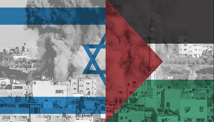
CONTROVERSIAL HISTORY OF KASHMIR CONFLICT AND ITS GEOGRAPHICAL IMPORTANCE
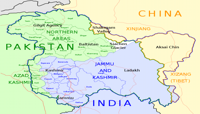
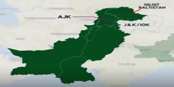
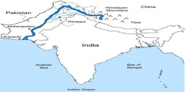
Kashmir is located among India, Pakistan and China. Kashmir consists of many parts; first Gilgit-Baltistan (GB) and Azad Jammu Kashmir (AJK) which is administrated and control by Pakistan. It is 30 percent of Kashmir land on Pakistani side; Second Indian Occupied Kashmir (IOK) control 55 percent of Kashmir region area on Indian side; Third after Indo-china war in 1962 china held the Askai chin area of Kashmir land from India. . Moreover, Pakistan gifted northern area of Kashmir territory region (Shaksgam Valley) to China in 1963 document between Sino-Pakistan boundary agreement. (Note: Sino is the old name of China). Now China is commanding 15 percent of Kashmir region. LAC is Line of Actual Control. It is Effective border between India and China marked by military. The LAC line separates Askai Chin part of Kashmir from IOK .it is not legally recognized internationally boundary, but it is the practical border of China. Mc Mohan Line is recognized as internationally boundary between China and India. . 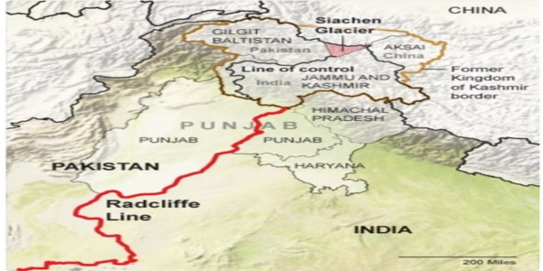
India claims whole Kashmir (AJK, Askai chin and Gilgit-Baltistan) on its official maps because it was legally merged with India signed by Maharaja Hari Singh on 26 October 1947. While Pakistan claims IOK and see itself on the official map because partition happen on the Hindu-Muslim theory and it has Muslim majority therefore Quid-e-Azam said about Kashmir that is; single person (Hari Singh) cannot decide the rights of whole nation of Kashmir. But as they actually exist, truth and fact on the map, Pakistan governs and administrated Gilgit-Baltistan and AJK that follows the current LOC line of control. .
Jammu and Kashmir Map with LOC
Now LOC is the border line and separates the Indian-controlled Kashmir from Pakistan-controlled Kashmir hold by military. It is 740 km in length. At the end of LOC Point of northern side is known as NJ9842 (Shia chin glacier) started. This point is also disputed region it is the world most dangerous and coldest battlefield ever. India had been operated to captured successfully since 1984 Shia chin region of 70 km area. .
LOC not recognized as international boundary and unofficial borders line between India and Pakistan because of Kashmir disputes and conflict. LOC initially named ceased fire line was established in Karachi agreement of 1949 signed by military of Pakistani and Indian and supervised by united nation. Afterwards, the Shimla agreement on 3rd July 1972, LOC was signed between the two countries. .
Internationally boundary is an accepted line that both nations use on their map. The International Boundary is created upon and drafted the Redcliffe line in 1947. its named after architect Sir Cyril Redcliffe who was appointment to draw the line of boundary. From end of LOC boundary Sialkot to Sindh region the two-nation divided known as Redcliffe line boundary.
Water Dispute Between India and Pakistan Summary
After the independence 1947, the water basin remained a main problem. In 1960 two countries signed the Indus water treaty brokered by world bank. According to this treaty, the Indus river major tributaries come under two categories the eastern rivers and western rivers. Eastern rivers were given to the India while western were given to rivers to Pakistan and India Could not restrict the flow of water.
Pakistan against the projects and dams on the northern Indian occupied Kashmir and criticizes India for delaying their expert inspection. Pakistan’s contention is that India is using the hydroelectric power of water of the rivers that rightly belong to them. On the other hand, India says it not contravening the treaty. India’s claim that they are run of the river dams and do not divert waters.
Water is crucial for both countries. India used significant hydroelectric from the region. Pakistan heavily dependent on the water for its Agriculture based economy. These are lifetime for Pakistan as about 60 percent of its GDP depend on agriculture. Therefore, Pakistan PM Imran was asking for Pakistani people and abroad Pakistani to donation for construction of dam which fall in this region for growing water requirements.

Jahanzaib Tanveer
Jahanzaib Tanveer has very charming personality he is doing MBA from reputed University in Pakistan. He had exposure of manage...


leave a comment